Where will the desalination
plants and infrastructure be placed?
Identifying possible locations
for needed infrastructure and six desalination plants required the
consideration of numerous factors. Determining topography, land ownership, and minimizing
environmental restrictions were factors paramount in determining the most
feasible and non-prohibitive routes where the desalination project could
be constructed.
Direct routing of pipeline, hundreds of kilometers long, was restrictively impossible because of environmental regulations on both sides of the border, sovereignty laws of Native American lands, and topography. To the greatest extent possible it was determined the project should bypass property or land that would require lengthy negotiations, extreme engineering, or endanger ecologically sensitive areas.
Direct routing of pipeline, hundreds of kilometers long, was restrictively impossible because of environmental regulations on both sides of the border, sovereignty laws of Native American lands, and topography. To the greatest extent possible it was determined the project should bypass property or land that would require lengthy negotiations, extreme engineering, or endanger ecologically sensitive areas.
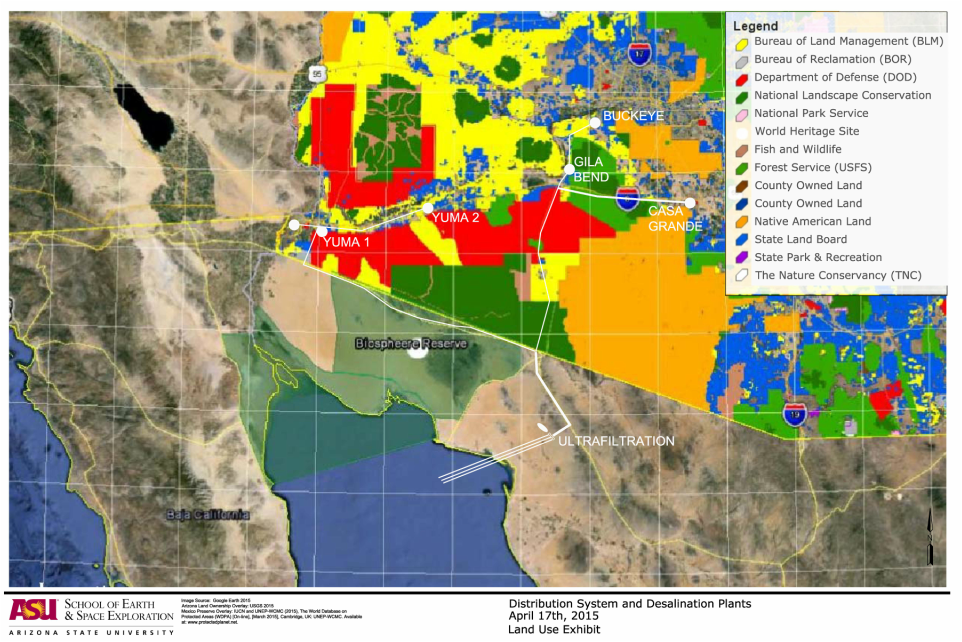
Land Use Overlay Map
The project is located within the Basin and Range physiographic province that contains primarily Small mountain ranges and broad desert valleys prevalent in southern Arizona and northern Mexico. These mountain ranges generally protrude 3,000 to 6,000 feet above the surrounding valley floor and commonly extend from 20 to 50 miles in a north or northwesterly direction [2].
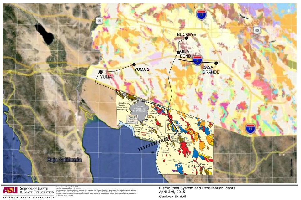
Geology Overlay Map
The geographic strata is varied but primarily of Quaternary surficial deposits. These deposits are unconsolidated to strongly consolidated alluvial and eolian deposits [1]. The six desalination plant locations were chosen to take advantage of both ground topography and geologic strata conducive to construction and aquifer recharge potential of desalinated water. The sites are located near Holocene River Alluvium which is unconsolidated to weakly consolidated sand and gravel in river channels and sand, silt, and clay on floodplains [1]. The Arizona Geological Society has a great interactive map showing the different types of geographic strata that was taken into consideration for the project [1].

Southwest Aquifer Map [2]
References
[1] The Arizona Geological Survey, Geological Map of AZ 2011. Available from http://data.azgs.az.gov/geologic-map-of-arizona[14 April 2015]
[2] United States Geological Survey, Ground water atlas of the United States Arizona, Colorado, New Mexico, Utah n.d. Available from http://pubs.usgs.gov/ha/ha730/ch_c/C-text1.html [14 April 2015].
